15 Best U.S. Road Trips for Outdoor Lovers (Scenic Drives + Itineraries)
# 15 Best U.S. Road Trips for Outdoor Lovers (Scenic Drives + Itineraries)
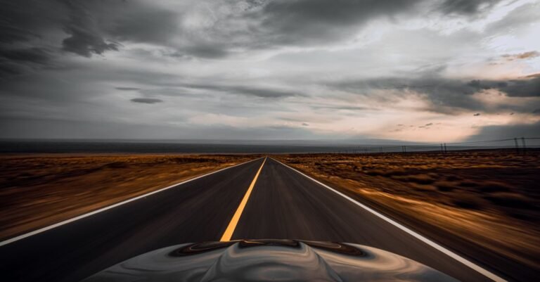
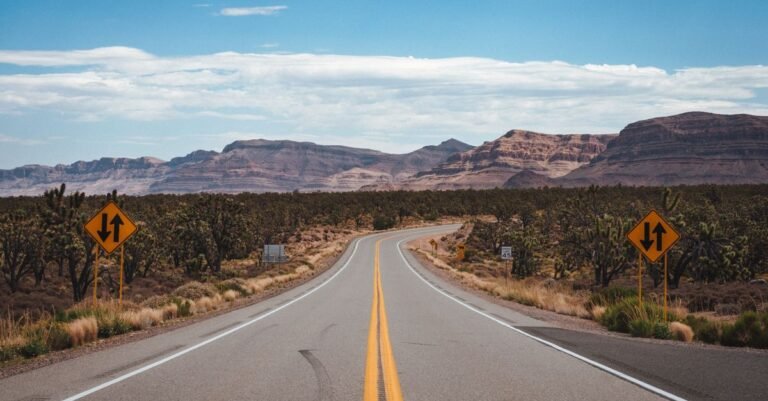
Some roads are just transportation. Others are the trip itself. The routes on this list belong to the second category: drives where the scenery demands constant stops, the trailheads are right off the pavement, and the journey genuinely rivals the destination.
Every trip here is chosen for outdoor lovers specifically. That means hiking trails, not just overlooks; campgrounds and public lands, not just resort towns; and routes where you can spend a week (or a long weekend) with your boots dusty and your phone forgotten. Distances, best seasons, and the single best hike on each route are included so you can match a trip to your available time.
How to Choose Your Road Trip
Match the trip to your constraints honestly. A long weekend (3-4 days) suits the Blue Ridge Parkway section, the San Juan Skyway, or the Columbia River Highway. A full week opens the Utah Mighty 5 or the Pacific Coast Highway. Two weeks lets you do the Great River Road or a big western loop properly.
Season matters more than anything. High-elevation routes (Beartooth, Going-to-the-Sun, San Juan Skyway) are summer-only. Desert routes (Utah, Joshua Tree, Valley of Fire) are best in spring and fall. Fall color routes (Blue Ridge, Natchez Trace, Skyline Drive) peak in October.
East Coast Favorites
1. Blue Ridge Parkway (Virginia to North Carolina)
Distance: 469 miles from Shenandoah to Great Smoky Mountains National Park Best season: Late spring for wildflowers, October for fall color Top hike: Rough Ridge or Craggy Gardens for big views with moderate effort
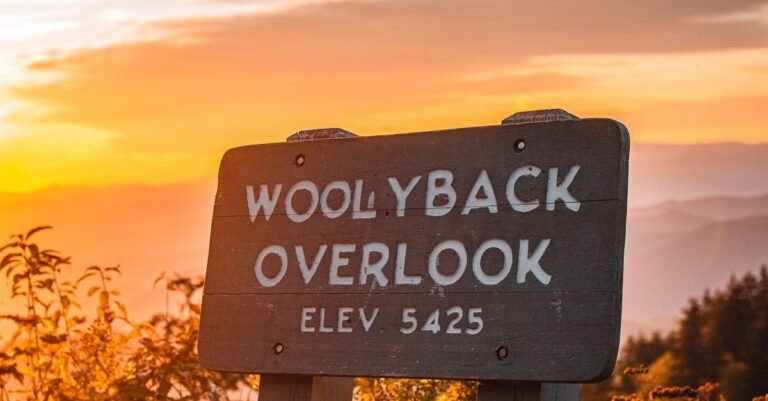
America's most famous scenic drive earns it. The Parkway strings together the best of the southern Appalachians: endless blue-ridge vistas, waterfalls, tunnels of rhododendron, and trailheads every few miles. There is no entrance fee and no commercial traffic, just 45 mph of pure scenery. Plan 3 to 5 days with stops, or drive a 100-mile section for a long weekend. The Linn Cove Viaduct and the Craggy Gardens area are must-stops.
2. Skyline Drive (Shenandoah National Park, Virginia)
Distance: 105 miles along the Blue Ridge crest Best season: Spring and fall Top hike: Old Rag (9 miles, strenuous scramble) or Dark Hollow Falls (easy waterfall)
Skyline Drive is the Blue Ridge Parkway's northern sibling, running the length of Shenandoah National Park. Seventy-five overlooks, 500 miles of trails accessible from the road, and frequent black bear and deer sightings. The $30 park entrance fee covers 7 days. This is the easiest trip on this list for East Coast city dwellers: under 2 hours from Washington DC.
3. Acadia and the Downeast Coast (Maine)
Distance: Flexible; base in Bar Harbor and explore Best season: Late June through October; fall color in early October Top hike: The Beehive (iron-rung ladders, thrilling) or Cadillac Mountain at sunrise
Acadia packs ocean, mountains, and forest into one compact national park. Drive the 27-mile Park Loop Road, hike iron-rung ladder trails you will not find anywhere else in the national park system, and eat lobster in Bar Harbor. Cadillac Mountain is famously one of the first places in the US to see sunrise (seasonally). Timed reservations are required for the Cadillac summit road in season, so book ahead.
Southern Adventures
4. Natchez Trace Parkway (Tennessee to Mississippi)
Distance: 444 miles from Nashville to Natchez Best season: Spring and fall Top hike: Short nature trails and waterfall stops; this is a cruising route
The Natchez Trace is the anti-interstate: no trucks, no billboards, no commercial traffic, just a 444-mile parkway following a historic travel corridor. Cypress swamps, waterfalls, Native American mounds, and small-town Mississippi. It is the most relaxing drive on this list and perfect for a slow 3 to 4 days. Free to drive, with free campgrounds along the route.
5. Overseas Highway (Florida Keys)
Distance: About 113 miles from Miami to Key West Best season: Winter and spring (avoid hurricane season and summer heat) Top outdoor stop: Bahia Honda State Park for the best beach in the Keys; kayak the backcountry
Forty-two bridges over turquoise water. The Overseas Highway is less about hiking and more about the surreal experience of driving across the ocean. Stop for snorkeling at John Pennekamp Coral Reef State Park, swim at Bahia Honda, and watch sunset from Key West. Winter is peak season with perfect weather.
6. Texas Hill Country Loop (Texas)
Distance: 300+ miles depending on route; base in Fredericksburg Best season: Spring for wildflowers (especially April bluebonnets), fall for mild weather Top hike: Enchanted Rock Summit Trail
Loop through Fredericksburg, Enchanted Rock State Natural Area, the Guadalupe River, and the small German-heritage towns. Spring wildflower season turns the whole region into a color show. Add swimming holes (Jacob's Well is currently closed to swimming; try Blue Hole in Wimberley with reservations) and you have a perfect long weekend from Austin, Dallas, or Houston.
Mountain West Epics
7. Utah Mighty 5 (Utah)
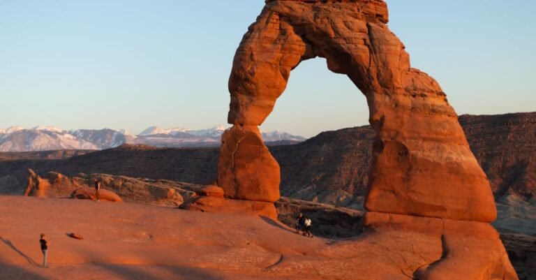
Distance: About 400 miles between parks; plan 7 to 10 days Best season: Spring and fall (avoid summer heat and crowds) Top hike: Delicate Arch (Arches), Angels Landing (Zion, permit required), Navajo Loop (Bryce)
The greatest national park road trip in America: Arches, Canyonlands, Capitol Reef, Bryce Canyon, and Zion in one loop. Red rock arches, slot canyons, hoodoos, and desert towers, each park completely different from the last. This trip needs a week minimum and rewards two. Book lodging and timed entries well ahead; this is the most popular park circuit in the country.
8. Beartooth Highway (Montana to Wyoming)
Distance: 68 miles from Red Lodge to the Yellowstone northeast entrance Best season: Late June through September (snow closes it otherwise) Top stop: The 10,947-foot summit and the alpine lakes along the route
Charles Kuralt called it the most beautiful drive in America, and he had a point. The Beartooth climbs from Montana ranch country to above 10,000 feet in 68 miles, crossing alpine tundra with 20 peaks visible. It is the perfect Yellowstone approach: drive it in, spend days in the park, and you have a legendary week.
9. Going-to-the-Sun Road (Glacier National Park, Montana)
Distance: 50 miles across Glacier National Park Best season: July through September Top hike: Highline Trail (cliffside views) or Grinnell Glacier
Fifty miles of engineering audacity across the Continental Divide, with vehicle reservations required in recent seasons during peak hours. Logan Pass sits at 6,646 feet amid mountain goats and wildflower meadows. Combine with the Many Glacier area for the park's best hiking. Book everything early; Glacier's short season concentrates all demand into 10 weeks.
10. San Juan Skyway (Colorado)
Distance: 236-mile loop through southwest Colorado Best season: Summer for full access; fall for golden aspen Top hike: Ice Lakes Basin or Blue Lakes Trail near Ridgway
The San Juan Skyway loops through Colorado's most dramatic mountains, including the Million Dollar Highway between Ouray and Silverton, a cliff-hanging stretch with no guardrails that thrill-seekers love. Ouray (the "Switzerland of America"), Telluride, and Durango anchor the loop. Hot springs, 14ers, alpine lakes, and old mining towns. Three to 4 days does it justice.
11. Pikes Peak Highway and the Colorado Front Range (Colorado)
Distance: Flexible; base in Colorado Springs or Denver Best season: Summer for the summit highway Top experience: Driving the 19-mile Pikes Peak Highway to 14,115 feet
Pair the Pikes Peak summit drive with Garden of the Gods (free), Rocky Mountain National Park (timed entry in season), and the Mount Blue Sky scenic byway for a Front Range week. This is the most accessible mountain road trip in America for beginners: huge alpine scenery with city comforts always nearby.
West Coast Classics
12. Pacific Coast Highway (California)
Distance: 600+ miles from San Francisco to Los Angeles (or reverse) Best season: Spring and fall (avoid summer fog and crowds) Top hike: Big Sur coastal trails; Point Lobos for easy stunning walks
The Big Sur section alone justifies the trip: cliffs plunging into the Pacific, the Bixby Bridge, redwood groves, and condors soaring overhead. Drive southbound so the ocean is on your side. Plan 3 to 5 days with stops in Monterey, Big Sur, San Simeon (Hearst Castle), and Santa Barbara. Check road conditions before going; landslides periodically close sections of Highway 1.
13. Olympic Peninsula Loop (Washington)
Distance: About 330-mile loop from Seattle Best season: July through September Top hike: Hoh Rainforest Hall of Mosses (easy) or Hurricane Ridge trails
One loop, three completely different ecosystems: temperate rainforest, alpine ridges, and wild Pacific beaches. The Hoh Rainforest gets 12+ feet of rain a year and looks like a fantasy novel. Rialto Beach's sea stacks at sunset are unforgettable. This is the most diverse road trip per mile in America. Plan 4 to 5 days.
14. Columbia River Highway and Central Oregon (Oregon)
Distance: Flexible; 2 to 4 days Best season: Spring for waterfalls, summer for the high desert Top hike: Eagle Creek Trail or Dog Mountain in the Gorge
Combine the Columbia River Gorge waterfall corridor (Multnomah Falls, Hood River, the Fruit Loop) with a drive south to Bend and the Cascade Lakes. Smith Rock State Park offers world-class rock climbing views on easy hiking trails. This route pairs lush waterfalls with high-desert sunshine in a single trip.
15. Valley of Fire and Southern Utah Extension (Nevada/Utah)
Distance: Flexible; pair with Zion or the Grand Canyon Best season: Fall through spring (avoid summer heat) Top hike: Fire Wave Trail (1.5 miles) or White Domes Loop
Valley of Fire State Park is Nevada's hidden gem: 2,000-year-old petroglyphs, swirling red and white sandstone, and the famous Fire Wave formation. It is an easy add-on to a Las Vegas arrival before heading to Zion (2.5 hours) or the Grand Canyon's North Rim. The $10-15 state park entry is a bargain.
Road Trips at a Glance
| Road trip | Distance | Best season | Ideal length | Top highlight |
|---|---|---|---|---|
| Blue Ridge Parkway | 469 mi | Spring/Fall | 3-5 days | Craggy Gardens, fall color |
| Skyline Drive | 105 mi | Spring/Fall | 2-3 days | Old Rag, bear sightings |
| Acadia/Downeast | Flexible | Jun-Oct | 3-4 days | Cadillac sunrise, Beehive |
| Natchez Trace | 444 mi | Spring/Fall | 3-4 days | Cypress swamps, no trucks |
| Overseas Highway | 113 mi | Winter/Spring | 3-4 days | 42 bridges, snorkeling |
| Texas Hill Country | 300+ mi | Spring/Fall | 3-4 days | Bluebonnets, Enchanted Rock |
| Utah Mighty 5 | 400+ mi | Spring/Fall | 7-10 days | Five parks, red rock |
| Beartooth Highway | 68 mi | Summer | 1-2 days + Yellowstone | Alpine tundra, 20 peaks |
| Going-to-the-Sun Road | 50 mi | Summer | 3-5 days + park | Logan Pass, Highline Trail |
| San Juan Skyway | 236 mi | Summer/Fall | 3-4 days | Million Dollar Highway |
| Pikes Peak/Front Range | Flexible | Summer | 4-7 days | 14,115-ft summit drive |
| Pacific Coast Highway | 600+ mi | Spring/Fall | 3-5 days | Big Sur cliffs |
| Olympic Peninsula | 330 mi | Summer | 4-5 days | Rainforest to beaches |
| Columbia River/Central OR | Flexible | Spring/Summer | 2-4 days | Waterfalls + high desert |
| Valley of Fire | Flexible | Fall-Spring | 1-2 days + parks | Fire Wave, petroglyphs |
Planning Tips for Big Road Trips
Book the popular stuff first. Timed entries (Glacier, Arches, Rocky Mountain NP), Cadillac Mountain sunrise, and Zion's Angels Landing permits all have limited availability. Lock these in before you book anything else.
The America the Beautiful pass pays for itself. At $80, it covers entrance fees at every national park and federal recreation site for a year. Two or three park visits and you are ahead.
Build in rest days. The biggest road trip mistake is driving every day. Schedule a zero-mile day in the middle of a week-long trip: sleep in, do laundry, swim in the lake. You will enjoy the second half twice as much.
Shoulder seasons are the cheat code. Late April, May, September, and October offer good weather, thin crowds, and lower prices on most of these routes. Summer is peak for a reason, but the shoulder months are often better.
Download everything offline. Maps, podcasts, audiobooks, and reservation confirmations. The best roads on this list have the worst cell service, and that is not a coincidence.
Frequently Asked Questions
What is the best road trip in the US for outdoor lovers?
The Utah Mighty 5 loop is the consensus pick: five national parks, endless hiking, and scenery that changes completely every day. For a shorter trip, the Blue Ridge Parkway offers the best scenery-per-day ratio. For maximum diversity, the Olympic Peninsula Loop packs rainforest, mountains, and beaches into 330 miles.
How long does the Blue Ridge Parkway take to drive?
The full 469 miles takes 3 to 5 days with stops, or 2 long days if you just drive. Most people do better picking a 100 to 150-mile section for a long weekend. The speed limit is 45 mph and the overlooks are constant, so plan on averaging under 30 mph.
What is the best time of year for a US road trip?
It depends on the route. Summer (June-August) for high mountain routes like Beartooth and Going-to-the-Sun. Spring and fall for deserts (Utah, Texas Hill Country) and fall color routes (Blue Ridge, Natchez Trace). Winter for the Florida Keys and the desert Southwest.
How much does a week-long road trip cost?
A rough budget: $100-200/night for lodging (less if camping), $50-80/day for food, $30-60/day for gas depending on distances, plus park fees and activities. A camping-based week for two can run $1,500-2,500; a hotel-based week more like $2,500-4,000. The America the Beautiful pass ($80) saves significantly on park fees.
Do I need reservations for national parks on a road trip?
Increasingly, yes. Many popular parks now use timed entry or permit systems for vehicles, specific roads, or famous hikes (Angels Landing in Zion, Cadillac Mountain in Acadia, Going-to-the-Sun Road in Glacier). Check each park's NPS page when planning and book the moment reservations open.
What is the most scenic drive in America?
There is no consensus, but the most-cited contenders are the Beartooth Highway, the Blue Ridge Parkway, the Pacific Coast Highway through Big Sur, and Going-to-the-Sun Road. Each wins in a different category: alpine drama, forested beauty, coastal scenery, and glacial majesty respectively. Drive all four and decide for yourself.
What is the best road trip app for navigation?
Download offline maps before you leave, because the most scenic routes have the worst cell service. Google Maps lets you save entire regions offline, and dedicated GPS apps work without any signal at all. A paper atlas as backup is old school, but it has never run out of battery in the desert.