Ultimate Pacific Coast Highway Road Trip Itinerary (5 Days)
There are drives, and then there is Highway 1. The Pacific Coast Highway is the road trip against which all other road trips are measured: 450-plus miles of California coastline where the road clings to cliffs, redwoods meet the sea, and every turn reveals a view that looks edited. If you only do one legendary American drive in your life, make it this one.
This itinerary covers the classic route from San Francisco to Los Angeles in five days, the ideal pace for experiencing it without rushing. You will get day-by-day stops with drive times, where to sleep, the best time to go, and the critical step most guides bury: checking that Highway 1 is actually open through Big Sur before you leave.
The Ultimate PCH Itinerary at a Glance
| Day | Route | Drive time | Highlights |
|---|---|---|---|
| 1 | San Francisco to Monterey | ~2 hours | Half Moon Bay, Santa Cruz, Cannery Row |
| 2 | Monterey area | Minimal | 17-Mile Drive, Carmel-by-the-Sea, Point Lobos |
| 3 | Monterey to Big Sur | ~1.5 hours (slow) | Bixby Creek Bridge, McWay Falls, Pfeiffer Beach |
| 4 | Big Sur to Santa Barbara | ~4 hours | San Simeon elephant seals, Morro Bay, Solvang |
| 5 | Santa Barbara to Los Angeles | ~2 hours | State Street, Malibu beaches, Santa Monica |
Why Drive North to South
Drive from San Francisco toward Los Angeles, not the reverse. Heading south puts you on the ocean side of the road for the entire trip, which means the pullouts, overlooks, and viewpoints are on your right: easy in, easy out, no crossing traffic to reach them. Heading north, every viewpoint requires a left turn across the highway. It is a small detail that transforms the whole experience. This is the single most repeated piece of PCH advice for good reason.
How Many Days Do You Need
| Trip length | Who it suits | What you get |
|---|---|---|
| 3 days | Long weekend warriors | Highlights only: Monterey, Big Sur, Santa Barbara, LA. Fast but doable. |
| 5 days | The sweet spot (this itinerary) | Full experience with time to hike, linger, and explore towns. |
| 7+ days | Slow travelers | Add San Diego, extra beach days, wine tasting, and detours like Hearst Castle. |
Five days lets you average under 100 miles of driving daily, which on this road is plenty. The PCH is slow by design: winding, two lanes, and constantly interrupting you with beauty.
Before You Go: Check Highway 1 Closures
This is the unglamorous step that saves trips. The Big Sur stretch of Highway 1 is carved into unstable cliffs, and landslides periodically close sections for weeks or months. In recent years, major slides have shut the road for extended repairs, sometimes with only escorted convoys or full closures.
Check Caltrans (dot.ca.gov) for current Highway 1 conditions before you finalize anything. If a closure blocks the Big Sur section, you have options: wait for reopening, route around via inland highways (less scenic but functional), or flip the trip to focus on the open sections. Do not discover a closure from a "Road Closed" sign at Ragged Point. Check a week before, and again the day before you leave.
Best Time to Drive the PCH
September through November is the sweet spot: warm days, less coastal fog, smaller crowds, and clear views. Spring (April to May) brings wildflowers and green hills with a higher chance of rain.
Summer has the warmest beach weather but also the infamous "June Gloom" marine layer that can hide the coast in fog, plus peak crowds and prices. Winter offers dramatic storm-watching and empty roads, but rain can trigger the landslides that close Big Sur, and some attractions reduce hours.
Day 1: San Francisco to Monterey
Leave San Francisco via Highway 1 (not the faster Highway 101 inland). The first stretch sets the tone: Half Moon Bay's wide beaches, the surf town of Santa Cruz with its historic Beach Boardwalk, and the quieter coves like Shark Fin Cove and Wilder Ranch State Park.
Stops: Half Moon Bay for coffee and the coastal trail, Santa Cruz Beach Boardwalk for classic Americana, Natural Bridges State Beach for the rock arch and monarch butterflies (in season, roughly October through February).
Evening in Monterey: Cannery Row's shops and restaurants, the working waterfront at Old Fisherman's Wharf, and sunset at Lovers Point in neighboring Pacific Grove. Eat seafood; you are on the Monterey Bay now.
Stay: Monterey or Pacific Grove.
Day 2: Monterey, Carmel, and 17-Mile Drive
A slow day with short drives and big payoffs.
Morning: the Monterey Bay Aquarium. Yes, it is popular. Yes, it is worth it. The kelp forest tank and sea otter exhibits are world-class, and it anchors the whole Monterey experience. Book tickets online in advance.
Midday: the 17-Mile Drive through Pebble Beach. It is a toll road, but the Lone Cypress, the ghost trees, and the manicured-meets-wild coastline justify it. Allow two hours with stops.
Afternoon: Carmel-by-the-Sea, the fairy-tale village of cottages, galleries, and a gorgeous white-sand beach. Walk Ocean Avenue to the sea, browse the galleries, and have lunch.
Late afternoon: Point Lobos State Natural Reserve, just south of Carmel. Short trails wind through cypress groves to coves full of sea lions, otters, and tide pools. Locals call it the crown jewel of the state park system, and an hour here explains why.
Stay: Monterey, Carmel, or push on to Big Sur lodging if you booked it.
Day 3: Big Sur (The Main Event)
Today is why you came. The roughly 70 miles from Carmel to San Simeon contain the most dramatic coastline in the contiguous United States. Drive slowly. Stop often. This is a day for the road itself.
The essential stops, north to south:
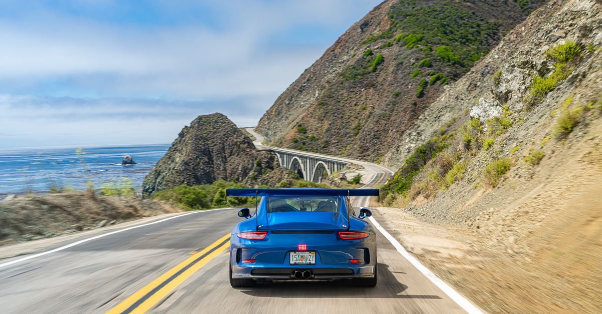
- Bixby Creek Bridge: the iconic concrete arch bridge. The viewpoint just north of the bridge gives the classic photo. Go early; the small pullouts fill fast.
- Pfeiffer Beach: turn off at the unmarked-ish road (a mile south of Big Sur Station) for purple sand, a rock arch offshore, and sunset light that photographers dream about. Parking is limited and there is a small day-use fee.
- McWay Falls: an 80-foot waterfall dropping onto a pristine beach in Julia Pfeiffer Burns State Park. You view it from the overlook trail; the beach itself is closed to protect it. Go midday when the sun lights the cove.
- Partington Cove: a short, steep trail through a tunnel to a rocky cove. A hidden gem most drivers miss.
- Ragged Point: the southern gateway, with gardens, cliffs, and a great lunch stop.
Hiking: if you want one trail, the Ewoldsen Trail or the short McWay Falls Overlook deliver big views for modest effort. Big Sur's longer trails climb steeply; save them for a dedicated hiking trip.
Stay: Big Sur lodges and campgrounds are limited and pricey; book far ahead. Alternatively, base in Cambria to the south, which has far more options.
Day 4: Big Sur to Santa Barbara via San Simeon
Morning: the Piedras Blancas Elephant Seal Vista Point near San Simeon. Hundreds of massive elephant seals lounge on the beach year-round, and the viewing area is free and right off the highway. It is one of the great free wildlife spectacles in America.
Hearst Castle (optional): the hilltop mansion of newspaper magnate William Randolph Hearst offers tours of its art-filled rooms and Roman-style pools. Tours take a few hours and should be booked ahead. Worth it for history and architecture fans; skippable if you would rather be outside.
Midday: Cambria's Moonstone Beach boardwalk for an easy coastal stroll, then Morro Bay with its unmistakable volcanic Morro Rock. Watch for sea otters in the harbor; the T-pier area is a reliable spot.
Afternoon detour: Solvang, the Danish village in the Santa Ynez Valley. Windmills, pastries, and wine tasting in a storybook setting. It is touristy and delightful.
Evening in Santa Barbara: State Street's shops and restaurants, the waterfront, and sunset at Butterfly Beach or Stearns Wharf. The "American Riviera" earns the nickname at golden hour.
Stay: Santa Barbara.
Day 5: Santa Barbara to Los Angeles
The final stretch is gentler: beach towns rather than cliffs.
Route: Highway 101 south through Ventura, then the coast through Malibu. Stop at El Matador State Beach for sea caves and rock formations, and the Malibu Pier for lunch.
Finish in Santa Monica: the pier, the beach, Third Street Promenade. You have driven one of the world's great roads. Walk to the end of the pier, look back north up the coast you just traveled, and feel appropriately accomplished.
Stay: Santa Monica or Venice for the classic finish.
Wildlife Watching Along the PCH
The highway doubles as a wildlife corridor, and knowing what to look for adds a whole dimension to the drive. Gray whales migrate past the coast from December through April; scan from any high overlook in Big Sur and you may see spouts. Sea otters float in kelp beds at Morro Bay and Monterey, elephant seals haul out by the hundreds at Piedras Blancas near San Simeon, and California condors, with their ten-foot wingspans, ride thermals above the Big Sur cliffs. Bring binoculars. The best wildlife moments happen when you stop the car, get quiet, and watch for ten minutes.
The 3-Day Express Version
Only have a long weekend? It is rushed but possible:
- Day 1: San Francisco to Monterey, afternoon in Carmel and Point Lobos.
- Day 2: Monterey to Big Sur (all the essential stops), overnight in Cambria.
- Day 3: Cambria to Los Angeles via San Simeon seals, Morro Bay, and Santa Barbara.
You will skip the aquarium, Solvang, and lingering. It is a highlights reel, but the highlights are spectacular.
Where to Stay
| Night | Base | Notes |
|---|---|---|
| 1 | Monterey / Pacific Grove | Wide range; book Cannery Row area for walkability |
| 2 | Monterey / Carmel | Or Big Sur if you scored lodging there |
| 3 | Big Sur / Cambria | Big Sur books out far ahead; Cambria is the practical base |
| 4 | Santa Barbara | Book downtown or waterfront for the full experience |
Big Sur lodging (and campgrounds) can sell out months ahead in summer and fall. If Big Sur is full, Cambria works beautifully as a southern base.
What to Pack
Layers are the theme: coastal mornings can be foggy and 55 degrees even when afternoons hit 75. Bring a warm jacket, comfortable walking shoes, swim gear for the southern beaches, sun protection, and a camera with plenty of storage. Download offline maps; cell service drops out along Big Sur. Pack snacks and water for the Big Sur day, where services are sparse and pricey.
What the PCH Costs (5 Days, Two People)
| Category | Typical range | Notes |
|---|---|---|
| Lodging (4 nights) | $600-1,200 | California coast is pricey; book early |
| Food | $400-600 | Mix of groceries, casual spots, and a few nice dinners |
| Gas (~600 miles) | $80-120 | Plus the rental if you fly in |
| Attractions | $100-200 | Aquarium, 17-Mile Drive toll, Hearst Castle tour, parking fees |
| Total | $1,180-2,120 | Camping 1-2 nights cuts this significantly |
Money savers: camp at Kirk Creek or Plaskett Creek in Big Sur (stunning, cheap, book ahead), picnic from grocery stores in Monterey and Santa Barbara, and visit the free attractions (elephant seals, Point Lobos, beaches) generously.
Best Photo Spots on the PCH
- Bixby Creek Bridge at golden hour: the classic shot. Shoot from the pullout just north of the bridge.
- McWay Falls from the overlook trail: midday light fills the cove best.
- Pfeiffer Beach at sunset: the rock arch glows, and in winter the sun aligns through it.
- Morro Rock at dawn: the volcanic plug silhouetted against pastel skies, otters in the foreground if you are lucky.
- El Matador Beach: sea caves and rock formations at low tide; check tide tables.
8 PCH Tips
- Drive south. Ocean side, easy pullouts, better views. Non-negotiable.
- Check Caltrans for closures. Big Sur slides are real. Verify before you go.
- Start Big Sur early. The light is best and the pullouts are emptiest before 10 AM.
- Fuel up before Big Sur. Gas stations are few and expensive on the remote stretch. Fill in Monterey or Cambria.
- Do not stop in travel lanes. Use designated pullouts only. The road is narrow and unforgiving.
- Watch for fog. If the marine layer rolls in, slow down and use low beams. The views will return.
- Book Big Sur lodging early. Months early, for peak season.
- Build in unscheduled time. The best PCH moments are unplanned: the seal on the beach, the perfect light at an unnamed overlook, the pie shop you did not expect.
Frequently Asked Questions
How long does it take to drive the Pacific Coast Highway?
The San Francisco to Los Angeles route is about 450-480 miles, or 10-12 hours of pure driving. But driving it without stopping misses the point. Plan 3 days minimum for highlights, 5 days for the full experience, and 7 or more to linger.
What is the best direction to drive the Pacific Coast Highway?
North to south (San Francisco to Los Angeles). You stay on the ocean side of the road, making scenic pullouts easy and safe to access.
Is Highway 1 through Big Sur open?
It varies. Landslides periodically close sections of Highway 1 through Big Sur for repairs lasting weeks to months. Always check Caltrans current conditions before your trip and have a backup plan.
When is the best time to drive the PCH?
September through November offers the best combination of clear skies, warm days, and smaller crowds. Spring brings wildflowers. Summer has beach weather but coastal fog and peak crowds. Winter is dramatic but rainy with possible closures.
Where should I stop on the Pacific Coast Highway?
The essential stops: Half Moon Bay, Santa Cruz, Monterey Bay Aquarium, 17-Mile Drive, Carmel, Point Lobos, Bixby Creek Bridge, McWay Falls, Pfeiffer Beach, elephant seals at San Simeon, Morro Bay, Solvang, and Santa Barbara.
Can I do the PCH in a regular car?
Absolutely. The entire route is paved highway suitable for any car. No special vehicle is needed, though a convertible is the classic (and very fun) choice.
How much does a PCH road trip cost?
For two people over five days, budget roughly $1,200-2,100 including lodging, food, gas, and attractions. Camping a couple of nights and picnicking from groceries bring it down substantially.
Is Big Sur worth it if Highway 1 is partially closed?
If the closure blocks the heart of Big Sur, consider rerouting: the Monterey-to-Cambria coast is the essential stretch. A closure south of the key sights still allows the best viewpoints from the north. Check Caltrans maps carefully; sometimes the closure affects only a small segment with detours.
Highway 1 is not just a road; it is a reminder of why road trips exist. Five days, 450 miles, and a coastline that never stops showing off. Drive it south, stop often, and take the long way whenever the long way is offered. On the PCH, it always is.