The Weekend Warrior’s Guide to the Blue Ridge Parkway (2026 Guide)
# The Weekend Warrior's Guide to the Blue Ridge Parkway (2026 Guide)
The Blue Ridge Parkway is 469 miles of pure Appalachian scenery, winding from Shenandoah National Park in Virginia to Great Smoky Mountains National Park in North Carolina. It is the most visited unit in the entire National Park System, it charges no entrance fee, and its speed limit tops out at 45 mph. That last fact tells you everything about the intended experience: this road is not for getting somewhere. It is for being somewhere.
You cannot do all 469 miles justice in a weekend, and you should not try. The smart weekend play is to base yourself in Asheville, North Carolina, and drive the most spectacular stretch of the parkway: the high country from Asheville north to Blowing Rock, then the southern highlands from Asheville toward Cherokee. This strategy gives you the viaduct, the waterfalls, the highest peak in the East, and the best sunset on the parkway, all within easy day-trip range of a great food city. It is the highest scenic return per mile of any weekend road trip in the eastern United States. This guide gives you the complete milepost-by-milepost plan, the best short hikes, the top sunset spots, and everything you need for three perfect days.
Blue Ridge Parkway Basics
The road. The parkway took 52 years to complete, and it shows in the best way. No billboards, no commercial traffic, just a winding two-lane road stitched along the ridgelines with overlooks every few miles. The 45 mph speed limit is strictly enforced and genuinely part of the design.
No entrance fee. Unlike the national parks at either end, the parkway is free to drive. You will pay nothing to enter and nothing to stop at overlooks.
Mileposts are your GPS. Everything on the parkway is measured in mileposts from 0 (Shenandoah) to 469 (Great Smoky Mountains). Learn to navigate by them. Cell service is unreliable along much of the route, so screenshot or print your stop list.
Seasons. Late spring brings rhododendron and mountain laurel blooms. Summer is lush and cool at elevation. Fall is the superstar: peak color typically runs mid to late October, with the highest elevations peaking around mid-October. Winter brings closures; sections of the parkway shut down with ice and snow, so check NPS alerts before a cold-weather trip.
The weekend segment. This itinerary covers roughly mileposts 290 to 470, the North Carolina high country and southern highlands, based in Asheville. It is the most dramatic part of the parkway and the most practical for a long weekend.
Key stops at a glance (north to south)
| Stop | Milepost | Why go |
|---|---|---|
| Moses H. Cone Memorial Park | 294 | Carriage roads, manor house, crafts |
| Linn Cove Viaduct | 304 | 1,243-ft engineering marvel |
| Linville Falls | 316 | Major waterfall, multiple viewpoints |
| Mount Mitchell | 355.4 (spur) | Highest peak east of the Mississippi (6,684 ft) |
| Craggy Gardens | 364.4 | Rhododendron tunnels, Pinnacle views |
| Mount Pisgah | 408.6 | Campground, trails, inn |
| Graveyard Fields | 418.8 | Waterfalls and meadows |
| Black Balsam Knob | 420.2 | Treeless balds, 360-degree views |
| Waterrock Knob | 451.2 | Premier sunset spot |
Day 1: Asheville to the Crags (Northbound)
Morning: Craggy Gardens
Leave Asheville after breakfast and join the parkway heading north. Your first stop is Craggy Gardens at milepost 364.4, about 40 minutes from downtown. In late May and June, the rhododendron tunnels here explode in pink and purple blooms. Year-round, the short climb to Craggy Pinnacle (about 20 minutes up) delivers one of the best views on the entire parkway, with twisted, wind-sculpted trees framing the layered ridges.
Walk the Craggy Gardens Trail through the rhododendron, then do the Pinnacle. Give it two hours.
Midday: Mount Mitchell
Continue north to the Mount Mitchell spur road near milepost 355. At 6,684 feet, Mount Mitchell is the highest peak east of the Mississippi River. A short paved path leads from the parking area to the observation deck, where the view on a clear day stretches for dozens of miles. There is a small museum and a restaurant at the summit for lunch with a view.
The drive up is half the experience, climbing through spruce-fir forest that feels more like Canada than Carolina.
Afternoon: Into the high country
Continue north toward Blowing Rock. Stop at the Linn Cove Viaduct overlook at milepost 304.4 to gaze at the parkway's greatest engineering feat: a 1,243-foot curving concrete bridge that hugs the precipitous face of Grandfather Mountain, built to avoid scarring the fragile mountainside. The visitor center explains how it was constructed from the top down, one segment at a time.
Overnight in Blowing Rock or Boone. Blowing Rock is the storybook mountain village, all gift shops and the excellent Blowing Rock Art & History Museum. Boone is a college town with a livelier food and brewery scene. Both make great bases.
Day 2: Waterfalls and Grandfather Mountain
Morning: Linville Falls
Backtrack slightly south to Linville Falls at milepost 316. Several trails of varying length lead to viewpoints of the falls plunging through a rugged gorge. The Erwins View trail (under a mile round trip) hits the main overlooks. For more, continue to Chimney View. Morning light is best for photography, and the crowds are thinner.
Midday: Moses H. Cone Memorial Park
At milepost 294, the Moses H. Cone estate offers 25-plus miles of gentle carriage roads perfect for walking or an easy bike ride. The manor house hosts craft demonstrations. The Bass Lake loop is an easy, scenic stroll. This is your relaxed midday stop between bigger adventures.
Afternoon: Grandfather Mountain (optional detour)
Just off the parkway, Grandfather Mountain offers the famous Mile High Swinging Bridge, wildlife habitats, and rugged trails. It is a private attraction with an admission fee, separate from the parkway. If heights and spectacular exposure appeal to you, it is worth half a day. If not, spend the extra time on the parkway's overlooks.
Evening: Back to Asheville
Drive south back to Asheville for the night. Downtown Asheville's food and brewery scene is the best on this itinerary, so plan a proper dinner. The city's River Arts District and downtown galleries make a good evening stroll.
Day 3: The Southern Highlands and a Sunset Finale
Morning: Mount Pisgah
Head south from Asheville on the parkway to the Mount Pisgah area at milepost 408.6. The Mount Pisgah Trail climbs through hardwood forest to a viewing platform with sweeping views. The campground here makes a good base if you are camping the weekend. The Pisgah Inn, perched on the ridge, serves lunch with a view.
Midday: Graveyard Fields
At milepost 418.8, Graveyard Fields is unlike anywhere else on the parkway: an open, high-elevation valley with waterfalls, wildflower meadows, and boardwalk trails. The hike to Upper and Lower Falls is easy and rewarding. In fall, the blueberry bushes turn the whole valley crimson. It is a perfect picnic spot.
Afternoon: Black Balsam Knob
A few miles south at milepost 420.2, the Black Balsam Knob trail climbs onto treeless mountain balds with 360-degree views. The Art Loeb Trail crosses here too. The open, grassy summits feel more like the Scottish Highlands than North Carolina. It is one of the most photographed spots on the parkway for good reason.
Sunset: Waterrock Knob
Save the best for last. Drive to Waterrock Knob at milepost 451.2, one of the highest points on the parkway and its premier sunset spot. The short but steep trail to the summit offers panoramic views in every direction. Arrive 45 minutes before sunset, bring a jacket (it is exposed and windy), and watch the sun drop behind the Smokies. Then drive the remaining miles to the parkway's southern terminus near Cherokee, or head back to Asheville.
Extending North: Virginia Highlights
If your weekend starts from the north or you have an extra day, Virginia's section of the parkway deserves attention. Mabry Mill at milepost 176.1 is the most photographed spot on the entire parkway: a historic gristmill with a blacksmith shop and weaving exhibits, especially lovely in morning light. The Blue Ridge Music Center at milepost 213 celebrates the region's old-time and bluegrass heritage with summer concerts that are free and fantastic.
Further north, the Peaks of Otter at milepost 86 offer a classic lodge, a lake, and the Sharp Top hike with big views for moderate effort. Humpback Rocks at milepost 5.8, near the parkway's northern start, has a short, steep trail to rocky outcrops with sweeping Shenandoah Valley views. If you are driving the full length over a long weekend, these Virginia stops break up the northern miles beautifully.
Photography Tips for the Parkway
The Blue Ridge Parkway is one of the most photographed roads in America, and a few techniques separate the snapshots from the stunners.
Chase the light, not the miles. The ridges photograph best in the first and last two hours of daylight, when low sun rakes across the layers and the famous blue haze glows. Midday light flattens everything. Plan your driving for midday and your overlook stops for morning and evening.
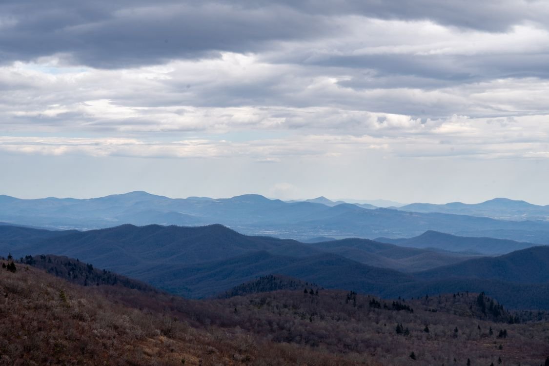
Use the layers. The classic Blue Ridge shot is ridges receding into blue distance. A moderate telephoto lens (or your phone's 2x zoom) compresses the layers beautifully. Include a foreground element, a fence, wildflowers, a gnarled tree, to anchor the composition.
Waterfalls need overcast. Linville Falls and the Graveyard Fields falls photograph best on cloudy days or in open shade, when you can slow your shutter without harsh highlights. A tiny tripod or even a rock-steady rock works.
Do not skip the fog. Mornings when valleys fill with fog and only the ridge tops float above it produce the most dramatic images on the parkway. If you wake to fog in Asheville, drive up immediately. It burns off fast.
The Best Short Hikes Along the Parkway
| Hike | Milepost | Distance | Payoff |
|---|---|---|---|
| Craggy Pinnacle | 364.4 | 1.4 mi RT | Best quick summit view |
| Mount Mitchell summit path | 355.4 spur | 0.5 mi RT | Highest point east of the Mississippi |
| Linville Falls (Erwins View) | 316 | 1.6 mi RT | Waterfall gorge overlooks |
| Graveyard Fields Falls | 418.8 | 3.2 mi RT | Two waterfalls, meadows |
| Black Balsam Knob | 420.2 | 1.5 mi RT | Treeless balds, 360 views |
| Waterrock Knob | 451.2 | 1.2 mi RT | Sunset panorama |
| Bass Lake loop (Moses Cone) | 294 | 0.8 mi loop | Easy lakeside stroll |
Where to Stay and Eat
Asheville is the ideal base: the most lodging, the best food, and central parkway access. Downtown has boutique hotels and the famous Biltmore area resorts. The River Arts District has more affordable, funky options.
Blowing Rock and Boone work well for the northern segment. Blowing Rock leans charming and upscale; Boone leans college-town lively.
Camping: The parkway has several campgrounds, including Mount Pisgah (MP 408.6) and Linville Falls (MP 316.4), typically open May through October, offering unbeatable ridge-top locations. They are first-come, first-served or reservable depending on the site; check NPS.gov. No hookups, but unbeatable locations.
Food: Asheville's food scene is the highlight: farm-to-table restaurants, legendary barbecue, biscuits done right, and a brewery count that rivals cities ten times its size. Make at least one dinner reservation in downtown Asheville before your trip, since the best spots book out on weekends. In Blowing Rock and Boone, expect cozy mountain-town dining: trout, fried chicken, and hearty breakfasts built for hikers. On the parkway itself, the Pisgah Inn restaurant and the Mount Mitchell restaurant offer meals with views that justify the prices. Pack picnic supplies for overlook lunches; the parkway's picnic areas, especially Craggy Gardens and Graveyard Fields, are superb, and a sandwich tastes better at 5,000 feet.
Packing Checklist
- Printed or screenshotted milepost stop list (spotty cell service)
- Layers: 20-degree temperature swings between Asheville and the high overlooks are normal
- Rain jacket: mountain weather changes fast
- Sturdy walking shoes for the short trails
- Picnic supplies and a cooler
- Binoculars for the long ridge views
- Camera: the overlooks demand it
- Full gas tank: no gas stations on the parkway itself
Frequently Asked Questions
How long does it take to drive the whole Blue Ridge Parkway?
The full 469 miles takes 10 to 12 hours of pure driving at the 45 mph limit, but that misses the point. Most people take 3 to 5 days with stops. This guide's weekend segment (Asheville area) covers the most scenic portion in 3 days.
What is the best section of the Blue Ridge Parkway for a weekend?
The North Carolina high country between Asheville and Blowing Rock (roughly MP 290-380) plus the southern highlands toward Cherokee (MP 400-469) pack the most dramatic scenery into the shortest distance. Base in Asheville and you can do both.
When is the best time to drive the Blue Ridge Parkway?
Mid to late October for fall color (book lodging far ahead), late May through June for rhododendron blooms and mild weather, summer for cool mountain escapes. Winter brings closures; always check NPS road status.
Is the Blue Ridge Parkway free?
Yes. There is no entrance fee for the parkway itself. Nearby attractions like Grandfather Mountain charge separate admission, and campgrounds have fees.
Can you drive the parkway in one day?
Physically yes, enjoyably no. Rushing 469 miles in a day means seeing it through a windshield at 45 mph. Pick a segment and savor it instead.
Are there gas stations on the Blue Ridge Parkway?
No. Fill up in Asheville, Blowing Rock, Boone, or other gateway towns before getting on the parkway. This is the most common rookie mistake.
Final Thoughts
The Blue Ridge Parkway rewards the driver who stops. Every overlook is an invitation, every trailhead a possibility, and the 45 mph limit is a gentle insistence that you slow down and look. In a life measured in deadlines and commutes, three days of ridge-top sunsets and waterfall mist is not just a trip. It is a reset button, and it is waiting at milepost 384, just outside Asheville. Three days on the Asheville segment gives you soaring viaducts and tumbling waterfalls, the highest peak in the entire East, and a sunset from Waterrock Knob that will permanently reset your standards. Drive it once, and you will understand why it is the most visited road in the entire National Park System, beloved by millions of travelers every single year.
Pair this with our 3-day Smoky Mountains itinerary: the parkway literally ends where the Smokies begin, making them perfect companion trips.